
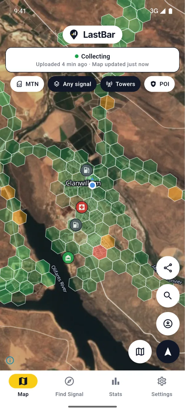
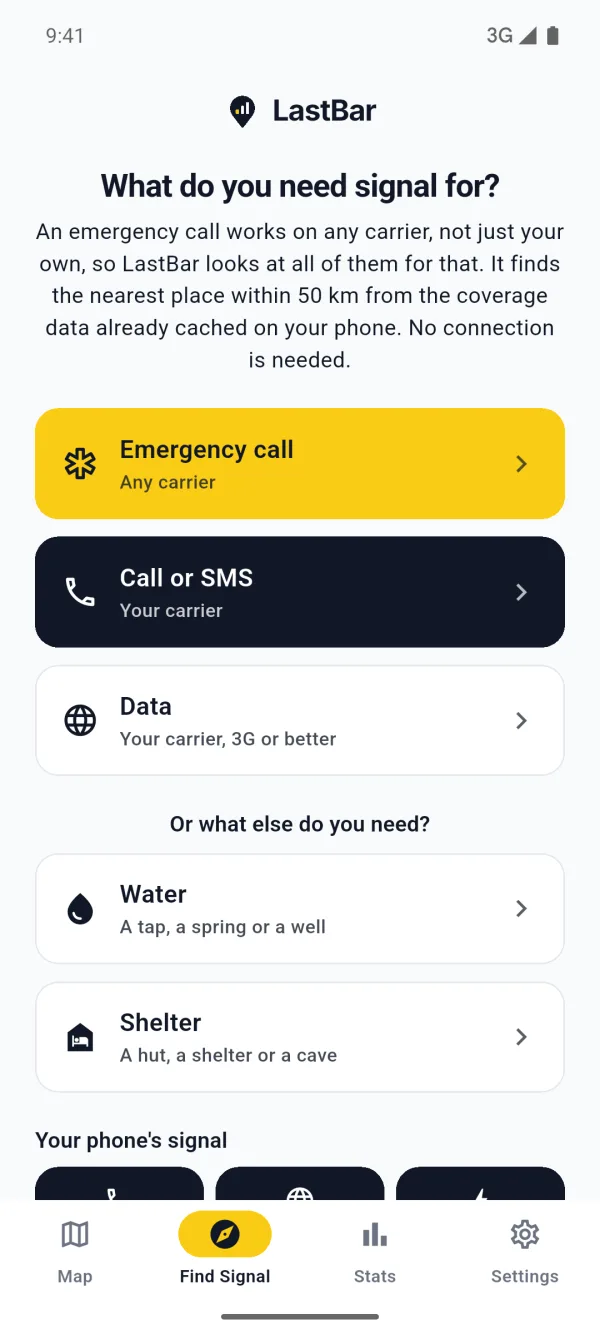
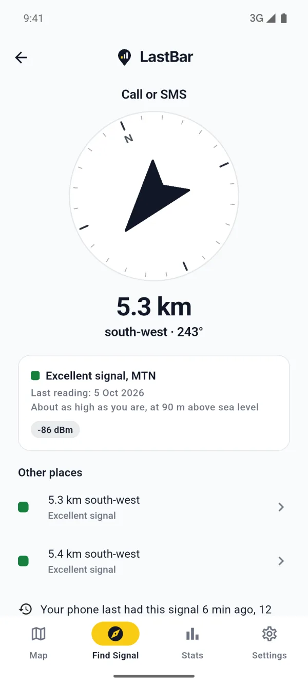
Your guests walk your trails and drive your 4x4 routes, and out there the phone often has nothing. LastBar shows each of them where the signal is, with no connection, guides them to the nearest place a call will go through, and shows the emergency numbers of the country. It is a map of what phones measured, not a carrier's prediction, so it can only show what a phone has recorded there before. If you run the reserve, the farm or the trail, you can make sure it has: walk and drive the trails once with an Android phone recording.
How long before guests see it
Readings from other phones reach everyone's map once they are 24 hours old, so that nobody can follow a phone on the map. The recording phone also has to send its readings, which it does as soon as it has a connection again, and the server folds them into the map every 10 minutes. Count on a day or two after you are back in signal; after that, every guest whose app fetches your area with a connection gets the new map.
What you need
- An Android phone. iPhones can't record in the background: Apple doesn't let an app measure signal while the screen is locked or the app is closed. Guests with iPhones can still use the map and Find Signal.
- Two or three phones on different networks, if you can. The map shows the best signal of every network, and an emergency call can use any network the phone can reach, so a second network fills in places the first has none. Staff phones on another network are ideal.
- A power bank. Continuous recording keeps the GPS on and uses much more battery than the standard setting.
Step by step
1. Install LastBar
Get LastBar on the recording phone from Google Play, open it and allow the permissions it asks for.
2. Set it to Continuous
In Settings, tap Take a reading every and choose Continuous: as you move. Instead of a reading every few minutes, the phone then takes one every 100 m you move, which is what a trail needs. In recent versions you can also tap the bar at the top of the map to choose it.
3. Keep Android from stopping it
- Battery saver off (Power saving on Samsung). On many phones it turns the GPS off while the screen is off, and then nothing is recorded. The bar at the top of the map says so when it is in the way.
- Let LastBar run in the background. In LastBar's Settings, open Running in the background and allow it. On Samsung, Huawei, Honor, Xiaomi, Oppo, Realme, OnePlus and Vivo phones the app also tells you which setting of the phone to switch. On Samsung: Settings, Apps, LastBar, Battery, and choose Unrestricted.
- Take a power bank for a long day on the trails.
4. Walk and drive every trail once
Walk each hiking trail on foot and drive each 4x4 route in a vehicle, at a normal pace, with the phone in a pocket or a mount; the screen may be off. The app maps as you move, so go everywhere your guests go:
- the trailheads and the parking,
- the overnight huts, camps and campsites,
- the viewpoints and the summits,
- the access roads and the tracks between them.
One pass is enough. If you have time, a second phone on another network on the same walk is worth more than a second walk with the same phone.
5. Check that it is recording
- The bar at the top of the map says Collecting continuously (in older versions of the app, just Collecting), and below it how many readings are waiting to upload.
- Your own readings appear on the map straight away, with a dark outline, before anything is uploaded. Tap one and it says so.
- If the bar says Collection paused, or that access is missing, tap it and fix what it names.

6. Let it upload
Back at the office or the house, give the phone a connection, mobile data or Wi-Fi, and open LastBar. It sends what it recorded, and the bar's count of readings to upload goes down to nothing. Readings wait on the phone for up to 90 days, so nothing is lost if that is only the next day.
7. Keep it current
The map counts recent readings for more than old ones, and older readings count for less over time. A walk once a season keeps your trails up to date, and so does every guest who uses LastBar on them. If you hear that the signal changed somewhere, walk that stretch again.
For your guests
The map is only on a guest's phone if it was fetched there, and most of your trails have no signal to fetch it with. Tell guests before they set out, while they still have a connection:
- Install LastBar and open it.
- Move the map over your reserve or farm and tap the download button to save the area. One saved area is free. LastBar keeps the map, the coverage and the water, shelter and help points of it on the phone.
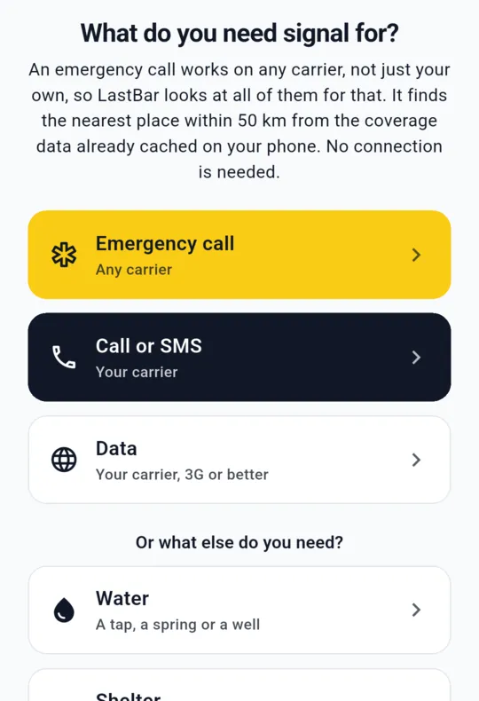
- Know where Find Signal is: with no connection, it points to the nearest place the phone will work, and shows the emergency numbers of the country.
Put it where guests already look: the booking confirmation, the welcome sheet, the trail map at reception, and a sign at the trailhead.
Find signal on our trails
Install LastBar and save this area before you set out. With no signal, it shows you the way to the nearest place your phone will work, and the emergency numbers.
Free for Android and iPhone
LastBar is no satellite messenger or personal locator beacon. Where no network reaches at all, it can only show the way back to the last place that had signal. It helps your own safety plan and your rangers and guides; it does not replace them.
Checklist: mapping the signal on your trails
- LastBar on the recording phone(s), Android, opened, the permissions it asks for allowed
- Phones on different networks, if you have them
- Settings, Take a reading every: Continuous: as you move
- Battery saver off; LastBar allowed to run in the background (Samsung: Battery, Unrestricted)
- Power bank and cable
- Every hiking trail on foot, every 4x4 route by vehicle, at a normal pace
- Trailheads, huts and camps, viewpoints and access roads included
- Check the bar says Collecting continuously and your hexagons appear
- Afterwards: a connection, open LastBar, wait until nothing is left to upload
- Tell guests: install LastBar, save the area before they set out, know Find Signal
- Once a season, or when the signal changed: walk it again
Run a reserve, farm or trail? Ask us for Pro codes for your rangers, guides and staff.
Pro adds the satellite map and up to ten saved areas. We are glad to give codes to the people who look after your guests, with nothing expected in return.
Organising a race or a ride on your land? See how to pre-record signal along your event route.
Questions people ask
How often should we record our trails?
Once is enough to put them on the map. The map counts recent readings for more than old ones, so a walk once a season, or after you hear the signal changed somewhere, keeps it current. Every guest who uses LastBar on your trails adds to it too.
Can we record with an iPhone?
No. An iPhone does not let an app measure signal in the background, so the recording phone must be Android. Guests with iPhones can still use the map and Find Signal.
Do our guests need signal on the trail?
No, if they saved your area before they set out. The map, the coverage and Find Signal then work with no connection.
Does the recording phone need signal while it records?
No. It records with or without a connection and keeps its readings for up to 90 days, then uploads them once it has a connection again.
Does LastBar call for help or tell anyone where a guest is?
No. It shows where the phone will work and the emergency numbers of the country, and the guest makes the call. It is no satellite messenger and does not replace your safety plan.