
LastBar for WordPress
Show your guests where their phones will have signal before they arrive. The free LastBar plugin puts a map of your camp site, lodge, reserve, trail or event on any page of your WordPress site, with the signal that real phones measured drawn over it.
Download the plugin (version 1.3.0, zip, 24 KB)Free. WordPress 6.0 or later, PHP 7.4 or later. Updates arrive in your WordPress dashboard.
What it does
One shortcode
Add [lastbar_coverage_map] with a latitude and a longitude to any page, post or Shortcode block. Choose the zoom, the size, a street or satellite map, and whether to show the legend.
Real measurements
Each hexagon is about 350 m across and shows the best signal of any carrier that LastBar users' phones measured there, from excellent to none. A hexagon only appears once at least two phones measured it.
Fast and private
The map is drawn by LastBar once, saved on your own site and refreshed every 7 days. Your visitors load a picture from your site: nothing about them is sent anywhere, and no cookies are set.
What it looks like on your site
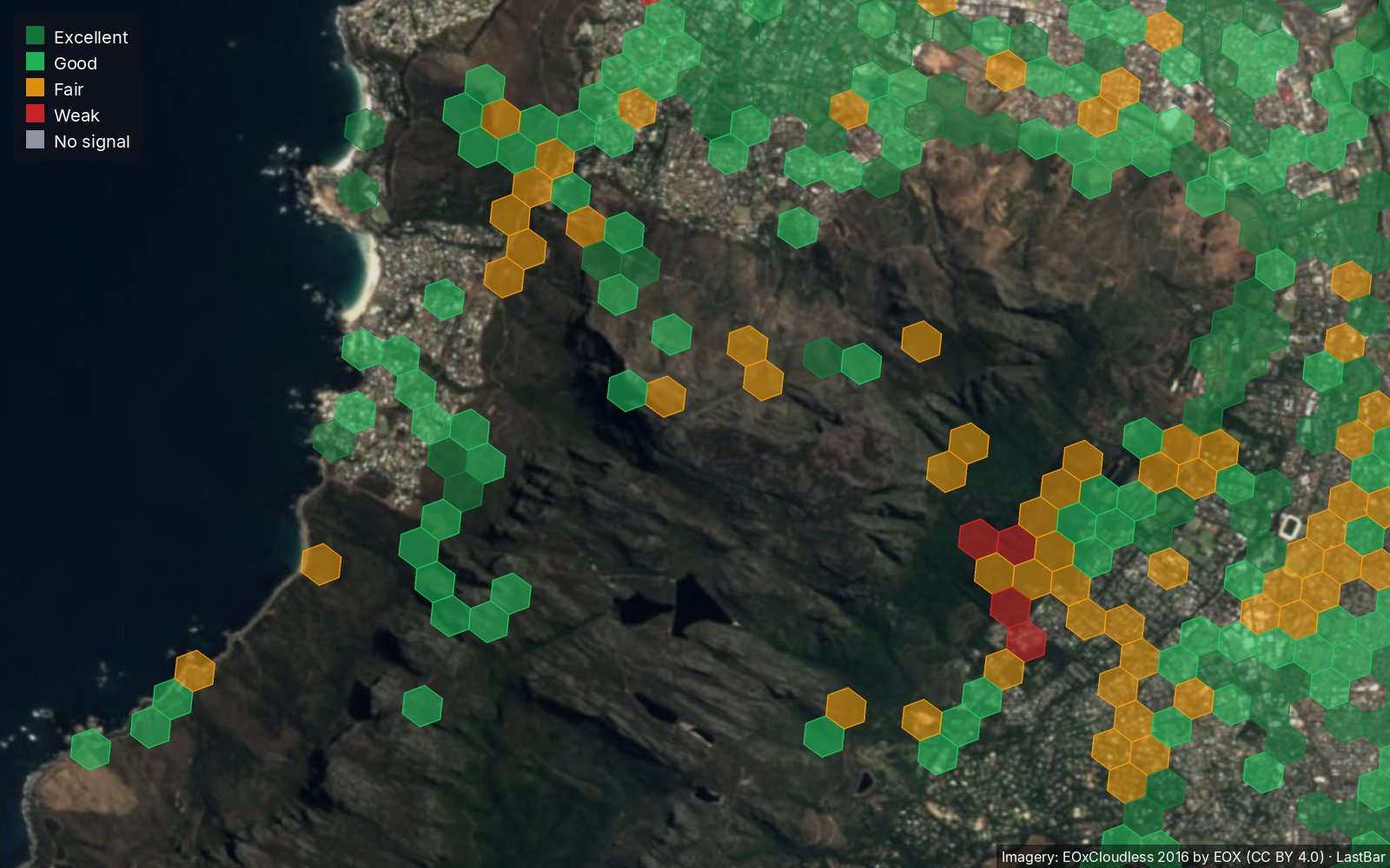
These are maps as the plugin shows them, with coverage measured by LastBar users.
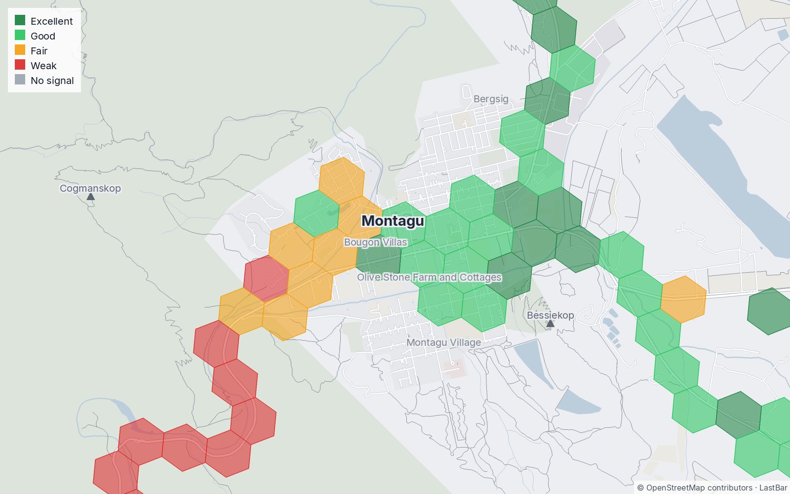
Street map
The default: a light street map with roads, towns and peaks named. Here, Montagu in the Western Cape, closer in.
[lastbar_coverage_map latitude="-33.789" longitude="20.118" zoom="14"]
Satellite
type="satellite" draws satellite imagery with the measured signal over it. Here, Table Mountain in Cape Town.
[lastbar_coverage_map latitude="-33.9628" longitude="18.4098" type="satellite"]
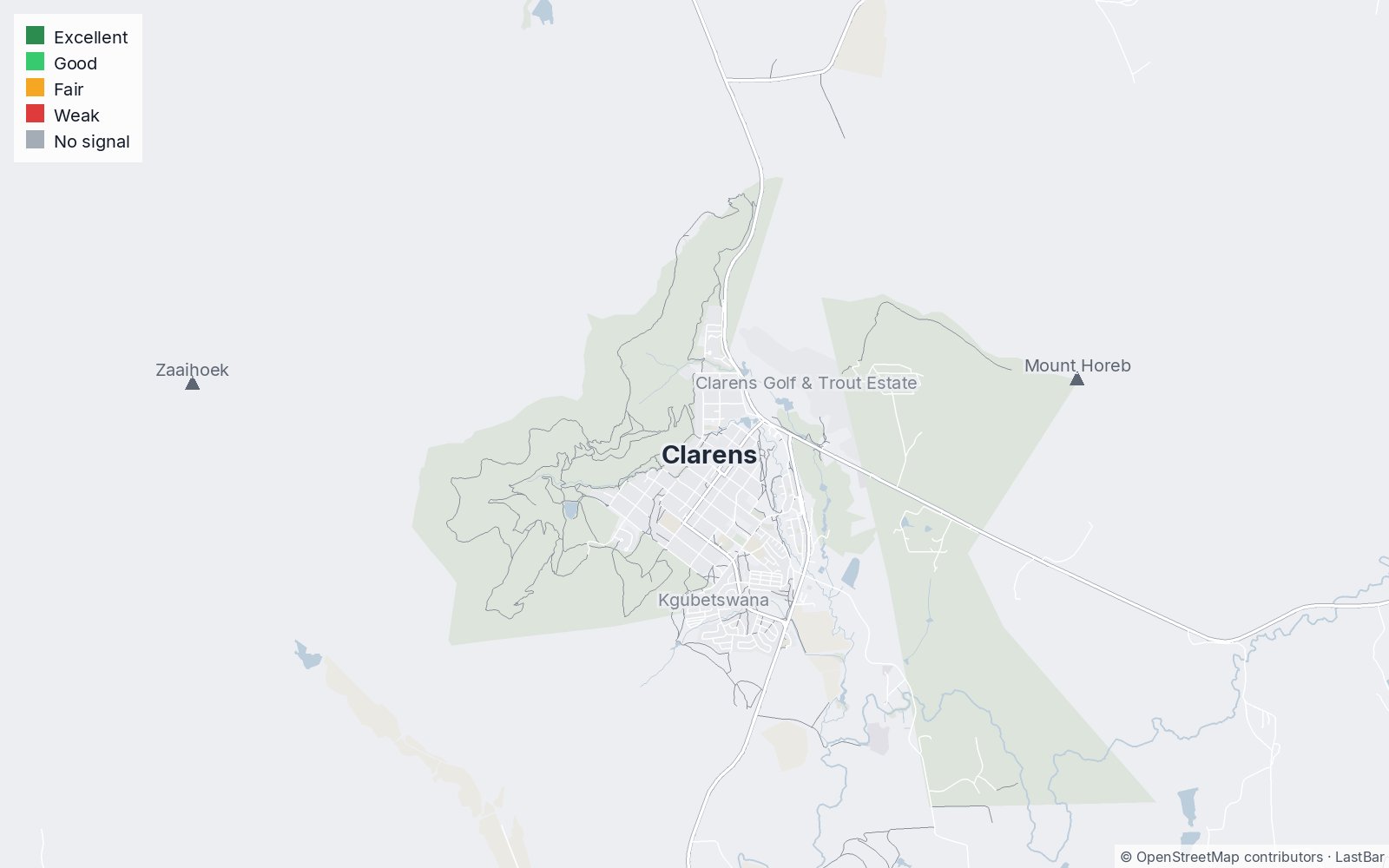
We don't have signal coverage data for this area yet, visit it with the free LastBar app to record some.
No coverage yet
Where nobody has recorded the signal yet, the map says so, and invites your visitors to record it with the free app.
[lastbar_coverage_map latitude="-28.512" longitude="28.418"]
In your WordPress admin
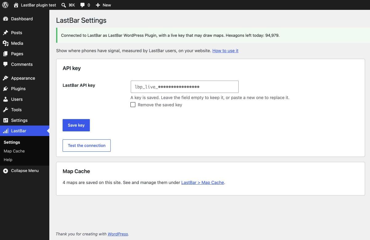
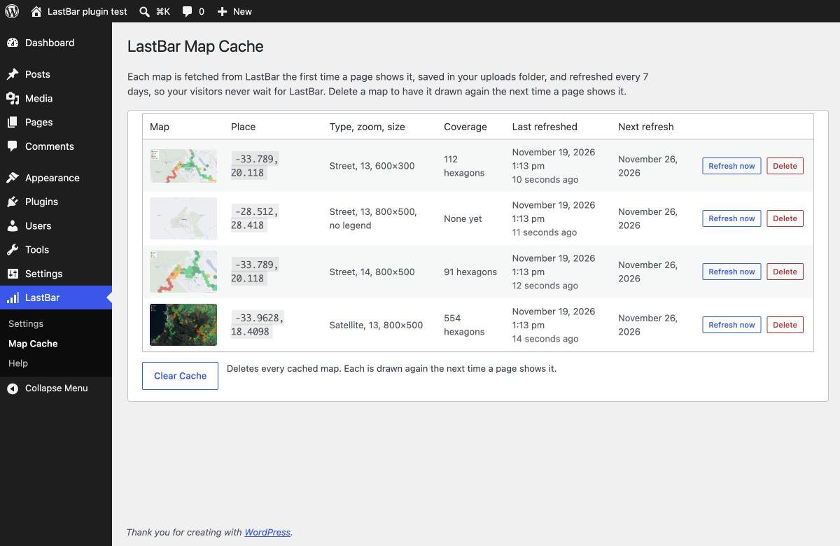
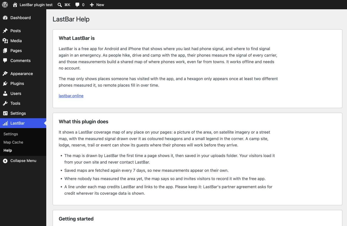
A LastBar menu with three screens: Settings, for your key and a test of the connection; Map Cache, the maps saved on your site with when each was refreshed and will be next, to refresh or delete one by one or clear all at once; and Help, which explains the shortcode and everything else.
How to set it up
-
1. Get a free API key
Apply at lastbar.online/developers/apply. Tick "Pull coverage data" and say it is for the LastBar map on your website. You will get your key by email once your application is approved.
-
2. Install the plugin
Download the ZIP above. In WordPress, go to Plugins, Add New, Upload Plugin, choose the ZIP, then Install Now and Activate.
-
3. Add your key
Open LastBar, Settings in the WordPress menu, paste the key, save it and click "Test the connection". LastBar, Map Cache shows the maps saved on your site, and LastBar, Help explains everything else.
-
4. Add a map
Find the latitude and longitude of your place (in Google Maps, right-click the spot and click the numbers to copy them) and add the shortcode to a page.
The shortcode
Only latitude and longitude are needed; everything else is optional.
| Attribute | What it does | Default |
|---|---|---|
latitude | The centre of the map, from -85 to 85. Required. | – |
longitude | The centre of the map, from -180 to 180. Required. | – |
zoom | From 5 (a region) to 16 (a few streets). 13 shows about 5 km across, 11 about 20 km. | 13 |
type | street (a light street map) or satellite. | street |
width, height | The size in pixels, up to 1280. The map shrinks to fit narrow screens and stays sharp on phones. | 800, 500 |
legend | yes or no: the legend of signal strengths in the top left corner. | yes |
alt | The text for screen readers. A description of the place is used if left out. | – |
Good to know
- The map grows. It only shows places someone has visited with the app. Ask your staff and guests to install LastBar: every visit with it adds to the map, and the plugin picks up new measurements within a week.
- Keep the credit. The line under each map credits LastBar and links to the app; the partner agreement asks for credit wherever its coverage data is shown.
- For developers. Other plugins and code snippets can ask for a map with the same attributes and get the URL of the picture on your site, fetched and saved first if needed:
clc_lastbar_map_url( array( 'latitude' => -33.9628, 'longitude' => 18.4098 ) ), or the filterclc_lastbar_map_url. LastBar, Help in WordPress has the details. - Updates. New versions appear under Dashboard, Updates in your WordPress, like any other plugin.
- What's new. Version 1.3.0 (19 November 2026): The type attribute is street (the default) or satellite; type="static" of earlier versions is still taken as street.
- Questions? Write to info@clc.agency. Building something other than a WordPress site? See the partner API.